 #147 MAIDENS COVE (GC341JF)
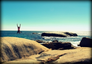
Maidens Cove near Clifton in Cape Town, South Africa
S33°56.691 E18°22.460
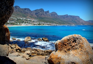
From Sea Point, the Suikerbossies and the Chappies set off to Maidens Cove near Clifton beach with its majestic view of the Twelve Apostles Mountain Range and promptly decided it is time for ye four maidens to lounge back and enjoy a delicious picnic lunch. We were treated to an artistic display by a pod of dolphins frolicking in the nearby waves, before continuing on along Victoria Road towards Oudekraal.
Visit Maidens Cove at www.geocaching.com
 #148 SHREK’S BOULDER (GCZZDA)
Along Victoria Road near Oudekraal Beach in Cape Town, South Africa
S33°58.965 E18°21.641
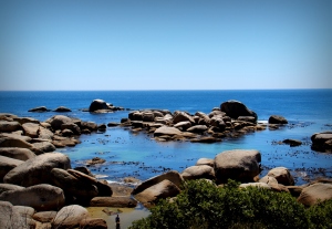
This aptly named cache is located near a lookout point along Victoria Road with panoramic views of the many and interesting granite boulders around Oudekraal beach – an excellent spot for anything from snorkelling to sundowners and definitely deserving of a favourite point!
Visit Shrek’s Boulder at www.geocaching.com
 #149 SS: ANTIPOLIS (GCK05H)
Along Victoria Road near Oudekraal Beach in Cape Town, South Africa
S33°59.075 E18°21.364
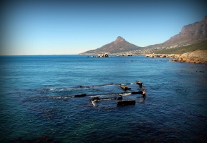
The Antipolis, along with the Romelia, where both derelict tankers being towed by small Japanese tug, Kiyo Maru No. 2 from Greece to scrap merchants in the Far East. On 28 July 1977 rough sea conditions, a fierce north-westerly gale and bad luck led to the tow-rope between the Antipolis and the tug to snag on the seabed. All attempts to free it failed and it eventually broke, setting the 24,119 ton tanker adrift.
The Antipolis quickly ran aground at Oudekraal; the gale driving her right up onto the rocks, punching holes into her stern. She was eventually cut down to sea level for her scrap metal with the remaining bits still visible 10 meters off the rocks at low tide.
Visit SS: Antipolis at www.geocaching.com
 #150 VICTORIA LOOKOUT (GC3V644)
Along Victoria Road near Llandudno in Cape Town, South Africa
S33°59.999 E18°20.630
Before continuing the tale of the Antipolis and Romelia, we quickly stopped for a park and grab cache at this popular lookout point along Victoria Road.
This road with its beautiful backdrop of the Twelve Apostles Mountain Range and sweeping views over the Atlantic Ocean was originally laid by Sir Thomas Bain in the 1880’s and named in honour of Queen Victoria’s Jubilee.
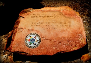
The recent upgrades and landscaping were made possible by a donation from a social enterprises organisation in memory of Pietro Ferrero – CEO of a giant Italian business group and heir to Italy’s biggest fortune, who died unexpectedly from an apparent heart attack while cycling near this spot. He was 47.
Visit Victoria Lookout at www.geocaching.com
 #151 SS: ROMELIA (GC2K05E)
Sunset Rocks near Llandudno Beach in Cape Town, South Africa
S34°00.726 E18°20.076
Llandudno – playground of the famed and affluent – named after the North Wales seaside resort of Llandudno, meaning “Parish of Saint Tudno” in the Welsh language, but also the final resting place of the Romelia.
With the tug, Kiyo Maru No. 2 involuntarily being anchored to the seabed by its tow-rope to the Antipolis, the Romelia – also being towed by the tug, started drifting ahead, its own tow-rope threatening to capsize the rugged little tug. While the snagged cable was being cut by blowtorch, the Romelia’s own tow-rope caught on the sea bottom. Emergency attempts to board the Romelia failed and the final tow-rope eventually snapped.
The 32,913 ton Romelia ran aground during the early hours of 29 July 1977 on Llandudno’s Sunset Rocks where she broke her back and quickly split in half. The wreck was a local landmark for many years until she slid into deeper waters not so very long ago and disappeared.
Visit SS: Romelia at www.geocaching.com
Our adventure will continue in Part 3 of this blog…
 #205 TABLE MOUNTAIN – CAPE TOWN (GC1ABZK)


